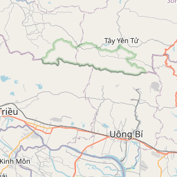


Description: SPOT 5 DIMAP image from investigation area VN 4 (LEGATO), Geometric Processing Level: PRECISION 2A, Resolution: 2.5m, Produced from 2 panchromatic channel (2.5 x 2.5m) and 1 multispectral (near infrared) channel (5.0m x 5.0m)
Global identifier:
Uuid(
    dc54a7c3-6a90-4f93-b05f-c9893281e1fb,
)
Origins: /Wissenschaft/Helmholtz-Gemeinschaft/UFZ/Metadatenkatalog
Tags: Wasserstraße ? Satellit ? LEGATO ? SPOT ? VN_4 ?
Bounding boxes: 106.268371° .. 106.527415° x 20.893351° .. 21.130746°
License: unbekannt
Language: Englisch/English
Modified: 2023-12-15
Time ranges: 2011-12-12 - 2012-06-01
Accessed 1 times.