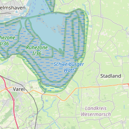

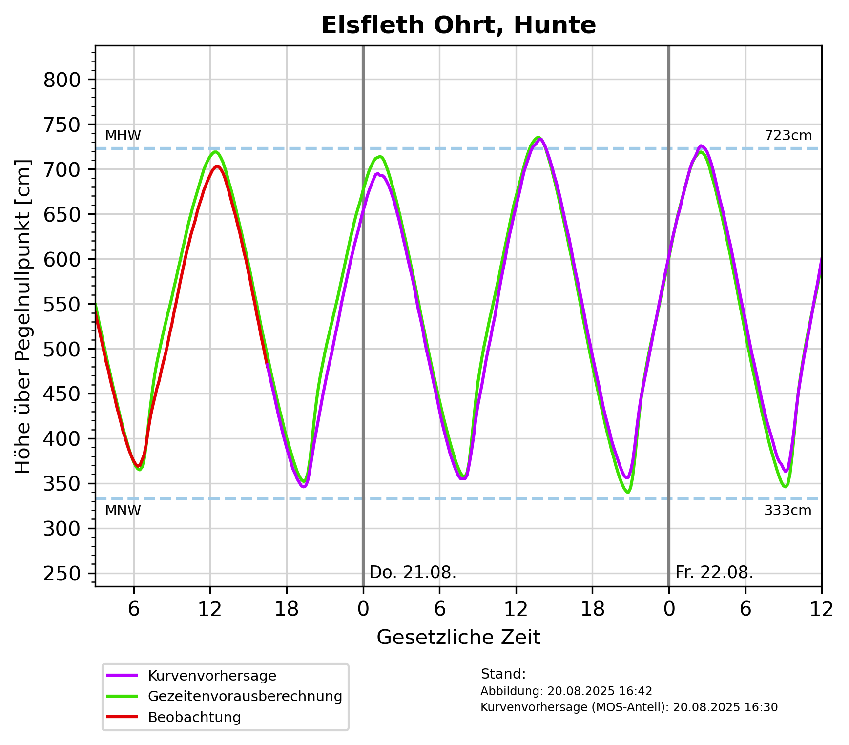
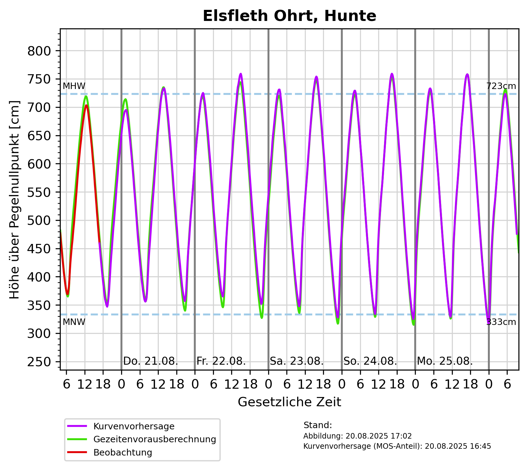
Description: Mittleres Hochwasser (MHW): 7m über Pegelnullpunkt, Mittleres Niedrigwasser (MNW): 3m über Pegelnullpunkt
Measurements {
    domain: Sea,
    station: Some(
        Station {
            id: Some(
                "Elsfleth Ohrt, Hunte",
            ),
            measurement_frequency: None,
            reporting_obligations: [],
        },
    ),
    measured_variables: [
        "Wasserstand",
    ],
    methods: [],
}
Origin: /Bund/BSH/Sturmflutwarndienst
Tags: Hochwasser ? Wasserstandsvorhersage ? Niedrigwasser ? Meeresgewässer ? Wasserstand ? Nordsee ?
Region: Weser
Bounding boxes: 8.46° .. 8.46° x 53.221111° .. 53.221111° 8.45683° .. 8.45683° x 53.63764° .. 53.63764°
License: all-rights-reserved
Language: Deutsch
Modified: 2025-04-01
Time ranges: 2025-04-01 - 2025-04-01
Aktuelle Messdaten über PEGELONLINE
https://www.pegelonline.wsv.de/gast/stammdaten?pegelnr=4960080 (Webseite) *Diagram für Vorhersagen für Tag_1-2: Höhe über pegelnullpunkt [cm]
https://www.sturmflutwarndienst.de/ersatzgrafik/DE__744A_Tag_1-2_PNP.png (PNG)Diagram für Vorhersagen für Tag_1-6: Höhe über pegelnullpunkt [cm]
https://www.sturmflutwarndienst.de/ersatzgrafik/DE__744A_Tag_1-6_PNP.png (PNG)Accessed 2 times.