

Description: Das Projekt "FP4-ENV 2C, Exploitation of TRMM Data for an Improved Weather and Climate Forecast" wird/wurde gefördert durch: Kommission der Europäischen Gemeinschaften Brüssel. Es wird/wurde ausgeführt durch: Deutsches Zentrum für Luft- und Raumfahrt e.V. - Deutsches Fernerkundungsdatenzentrum.General Information: The Tropical Rainfall Measurement Mission (TRMM) will be the first satellite for earth observation to embark a precipitation radar, in association with a microwave and VIS/IR imaging radiometer, in order to provide accurate measurements of the precipitation from space. Its inclination of orbit (+35A ) will allow to cover the tropical belt, where the latent heat release by deep convection is of major importance, and where the systematic observations are scarce. TRMM is a joint effort of the US and Japanese space agencies (NASA and NASDA), and will be launched in November 97, for a nominal life time of three years. The access of the European scientific community to the TRMM data constitutes an exceptional opportunity to test the impact of improved measurements of the global precipitation on the numerical weather prediction. This proposal arises from a group of European scientists whose competence covers remote sensing of the surface and of the atmosphere by active and passive techniques, moist convection dynamics, physics of the precipitation, large scale atmospheric dynamics and climate, operational numerical weather prediction. The objective of this group is twofold: (i) to process the TRMM data and products in order to provide assimilation data, or verification data for a numerical weather prediction (NWP) model; and (ii) to attempt assimilation of the precipitation data in a NWP model, and/or to use the precipitation data for testing and tuning schemes for paramerisation of convection. It is expected that this study, definitely driven by operational application would result in: - the development of better methods to assimilate SSM/I radiances in NWP models; - the validation and improvement of convection schemes in NWP models; - improved prediction of tropical storms and precipitation forecasts; - valuable guidance for the optimisation of future satellite observing systems. This proposal is fully compliant with Theme 3 of the work programme ('Space techniques Applied to Environmental Monitoring and Research'), area 3.1.2 ('Pilot Projects'), since two users are involved in the proposal. It is also relevant to Theme 1 - area 1.1.3 (Climate variability, simulation of climate and predichon of climate change), since it should lead to an improved representation of moist convection, a key dynamical process in a dynamical climate model. Prime Contractor: Centre National de la Recherche Scientifique (CNRS), Centre d'Etude des Environnements Terrestre et Planetaire (UMR 9988); Velizy-Villacoublay/France.
SupportProgram
Origins: /Bund/UBA/UFORDAT
Tags: Messgerät ? Aerodynamik ? Blei ? Klimatologie ? Latentwärme ? Meteorologie ? Radar ? Niederschlagsdaten ? Radiometrie ? Satellit ? Verfahrensoptimierung ? Umweltmonitoring ? Erdbeobachtung ? Wettervorhersage ? Monitoring ? Prognosemodell ? Klimamodell ? Simulation ? Studie ? Tropengebiet ? Daten ? Datenverarbeitung ? Mathematisches Modell ? Messdaten ? Atmosphäre ? Niederschlag ? Pilotprojekt ? Klimaanalyse ? Klimaentwicklung ? Sicherheit ? Wetter ? Feuchtigkeit ? Globale Aspekte ? Umweltschutz ? Fernerkundung ? Klimawandel ?
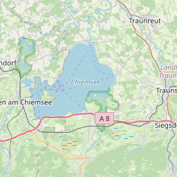
Region: Bayern
Bounding boxes: 12.53381° .. 12.53381° x 47.795° .. 47.795°
License: cc-by-nc-nd/4.0
Language: Englisch/English
Time ranges: 1998-02-01 - 2001-01-31
Accessed 1 times.