

Description: The main goal of this project was the investigation of the nitrogen of vegetation using remote sensing techniques. The small bandwidths of hyperspectral sensors in combination with the contiguous recording of the solar domain of the electromagnetic spectrum enable the derivation of plant constituents and pigments via their specific absorption features. Nitrogen does not reflect or absorb itself, but its amount can be derived indirectly via the chlorophyll absorption. In this study the focus lie on a combination of the chlorophyll/nitrogen content and specific plant water absorption at 960nm. Hyperspectral sensors are required to retrieve the pigment contents of plants. To do this the institutes own airborne imaging spectrometer AVIS (Airborne Visible/near Infrared Imaging Spectrometer) was used. The airborne measurements were supported by ground-based measurements, which were used to develop an empirical relationship between the nitrogen content of the vegetation canopies investigated and the remote sensing measurements. The primary intention was the investigation of permanent grassland. The cooperation with the Amt für Landwirtschaft Weilheim enabled the ancillary investigation of crops. Therefore, the main crop types, i.e. winter wheat (Triticum aestivum L.) and maize (Zea mays L.), were monitored in addition to the grassland canopies.
SupportProgram
Origins: /Bund/UBA/UFORDAT
Tags: Main ? Stickstoffgehalt ? Weizen ? Chlorophyll ? Mais ? Vegetation ? Hyperspektralsensor ? Pigment ? Sensor ? Stickstoff ? Absorption ? Grünland ? Winter ? Solaranlage ? Studie ? Wassergehalt ? Dauergrünland ? Fernerkundung ? Landwirtschaft ?
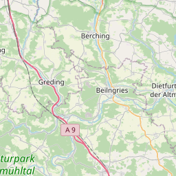
Region: Bavaria
Bounding boxes: 11.5° .. 11.5° x 49° .. 49°
License: cc-by-nc-nd/4.0
Language: Englisch/English
Time ranges: 1998-10-01 - 2002-06-01
Accessed 1 times.