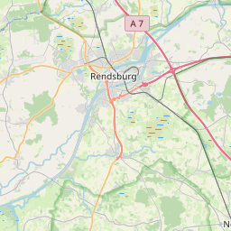


Description: Das Projekt "FP2-MAST 1, Geophysical in-situ probe" wird/wurde gefördert durch: Kommission der Europäischen Gemeinschaften Brüssel. Es wird/wurde ausgeführt durch: Universität Kiel.General Information/Project description: The knowledge of the physical parameters of marine sediments is important for the identification of sediment types and for the in-situ estimation of the rigidity of the sea-floor. The application of borehole logging methods in a miniaturised form, with probes driven into the sea floor gives direct access to the seismic velocities, electrical conductivity, natural gamma radiation and the U.Th.K - content of the sediment. Other parameters such as porosity, density and permeability can be derived from the logging results. The dynamic shear modulus, which correlates with the shear strength, can be determined from the integrated compress ional and shear wave experiment. The shear modulus will also be estimated from tube waves. In combination with high resolution seismic profiling methods, the new tool gives access to a 3-dimensional mapping of structures and the in-situ properties of marine sediments. Achievements: The subsurface structures of the sea floor can well be investigated with high resolution reflection seismic methods. Many geotechnical and environmental applications, however, need information on physical and chemical properties of sediments. For their assessment, penetration measurements are being developed combining bore hole logging and coring techniques. Two types of penetration devices were tested. The geotechnical module operates on the sea floor. Engine driven penetration allows a well controlled insertion of sensors into the sediment with a speed of 2 cm/s. Four parameters are acquired to a depth of 2 m: cone resistance, sleeve friction, excess differential pore pressure and wet bulk density. Furthermore, a 2 m long core can be obtained per launching. The geophysical in-situ probe is designed for penetrations of 10 m to 20 m into soft sediments, depending on their stiffness. The following parameters are assessed: wet bulk density, natural gamma radiation, electrical resistivity and compress ional wave velocities. The sensors are mounted at the lower end of a 10-20 m long penetration tube, which is loaded by a lead weight of 1.5 t at the upper end. The system is lowered by the ships winch to the sea floor, where it penetrates gravitationally into the sediment with a speed of about 10 cm/s. The depth is controlled by a pressure sensor with an accuracy of 1 cm. The data are transferred by cable to the recording and controlling units on board ship. Results of test measurements in the Baltic Sea show good correlation of physical parameters with seismo stratigraphic units. The geophysical in-situ probe penetration system is a fast and effective tool to assess physical parameters under in-situ conditions. The time for one measurement is only 2-3 minutes. Prime Contractor: Christian-Albrechts-Universität Kiel; Kiel; Germany.
SupportProgram
Origins: /Bund/UBA/UFORDAT
Tags: Gammastrahlung ? Kalium ? Blei ? Druckwelle ? Holzeinschlag ? Meeressediment ? Sensor ? Thorium ? Uran ? Geologischer Prozess ? Bodenstruktur ? Korrelationsanalyse ? Meeresboden ? Messprogramm ? Messtechnik ? Probenaufbereitung ? Prospektion ? Sedimentanalyse ? Seismik ? Stratigraphie ? U-Bahn ? Leitfähigkeit ? Bodenqualität ? Bodenphysik ? Messdaten ? Bohrkern ? Messverfahren ? Modul ? Permeabilität ? Chemikalien ? Schiff ? Chemische Zusammensetzung ? Daten ? Geophysik ? Sediment ? Bodenfeuchte ? Untergrund ? Bohrung ? in situ ? Probenahme ? Physikalische Größe ? Kenngröße ? Ostsee ? Auswertungsverfahren ? Untersuchungsprogramm ? Auflösungsvermögen ? Dichtebestimmung ? Insertion ? Mehrdimensionale Bewertung ? Messgenauigkeit ? Porosität ?
Region: Schleswig-Holstein
Bounding boxes: 9.75° .. 9.75° x 54.2° .. 54.2°
License: cc-by-nc-nd/4.0
Language: Englisch/English
Time ranges: 1991-02-01 - 1993-08-31
Accessed 1 times.