

Description: Das Projekt "Assessment of and Reliability of Transport Emission Models and Inventory Systems (ARTEMIS)" wird/wurde gefördert durch: Kommission der Europäischen Gemeinschaften Brüssel. Es wird/wurde ausgeführt durch: Forschungszentrum Karlsruhe GmbH in der Helmholtz-Gemeinschaft, Institut für Meteorologie und Klimaforschung, Teilinstitut für Atmosphärische Umweltforschung.Measurement campaigns were performed at the airports London-Heathrow and Vienna to get emission data during winter conditions in comparison to the summer measurements at these airports in July 2001. These measurements at airports were performed under the following conditions: - Start-up and idle thrust of main engines after finishing all services at the airport gates (London-Heathrow), - APU emissions of aircraft during service at the airport gate (London-Heathrow), and - extra stop of the aircraft on a taxi way with engine idle thrust (Vienna). - A fruitful co-operation with the airlines AUA, Tyrolean, and BA as well as the airport authorities supported this work. The same measurements methods as during the summer campaigns (see previous reports) were used. A high spectral resolution OPAG from Bruker was developed further in cooperation with the Hamburg University of Technology to a scanning imaging FTIR system (SIGIS). SIGIS is the OPAG with an azimuth-elevation-scanning mirror, a data acquisition and control system with digital signal processors (DSP), an infrared camera and a personal computer. With this instrumentation it is possible to visualise the plume and to obtain information about the temperature distribution within the plume. These measurements are performed at low spectral resolution, because the dynamic environment of these measurements limits the measurement time to about 2 minutes. This is the basis of a nearly automatic measurement modus in which the point of highest IR radiation is found to measure high spectral resolution spectra for the determination of temperature and composition of exhausts. This measurement system was tested and applied during both campaigns. The emissions of the main engines, as well as those of the APUs (auxiliary power units), were determined under typical engine conditions. The measured emission indices of CO show slightly higher values than those given in the International Civil Aviation Organisation (ICAO) data sheets but lower values for NOx emissions. In addition a high variance of emission indices in each aircraft family and from engine to engine was found. The newly developed scanning imaging FTIR spectrometer with the infrared camera (SIGIS) was used for automatic tracking of the jet engine and APU with the scanning mirror. The use of this system supported during the campaigns the other measurement methods. The emissions of the main engines, as well as those of the APUs (auxiliary power units), were determined under typical engine conditions. The measured emission indices of CO show slightly higher values than those given in the International Civil Aviation Organisation (ICAO) data sheets but lower values for NOx emissions for the engine status Idle. In addition a high variance of emission indices in each aircraft family and from engine to engine was found. usw.
SupportProgram
Origins: /Bund/UBA/UFORDAT
Tags: NOx-Emission ? Flugzeugabgas ? Infrarotstrahlung ? Messgerät ? Hamburg ? Flugplatz ? Messeinrichtung ? Temperaturverteilung ? Emissionsdaten ? Emissionsüberwachung ? Kohlenmonoxid ? Messtechnik ? Regeltechnik ? Schadstoffemission ? Sommer ? Stickoxide ? Winter ? Luftverschmutzung ? Bodenwert ? Emission ? Luftfahrzeug ? Energie ? Zivilluftfahrt ? Daten ? Messverfahren ? Messung ? Luftverkehrsemission ? Verkehrsemission ? Datenerhebung ? Nutzungsart ? Strahltriebwerk ? Zuverlässigkeit ? Datenspeicherung ?
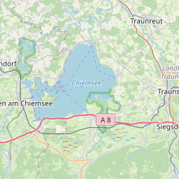
Region: Bayern
Bounding boxes: 12.53381° .. 12.53381° x 47.795° .. 47.795°
License: cc-by-nc-nd/4.0
Language: Englisch/English
Time ranges: 2000-01-01 - 2005-02-28
Accessed 1 times.