

Description: General Information: The basic objective of the project is 1) to develop, implement and demonstrate the use of coupled meteorological and hydrological models at the regional scale in order to improve flood forecasting and management in complex mountain watersheds. With this guideline further objectives are delineated as follows: 2) to apply coupled atmospheric-hydrological models to carry out a multi-scenario modelling experiment on the impact of reservoir regulations during hazardous flood events; 3) to investigate the benefits achievable in atmospheric models by introducing hydrological feedback with detailed land-surface schemes, including snow and ice dynamics; 4) to validate meteorological data generated by Numerical Weather Prediction (NWP) models and meteorological observations by means of runoff measurements and distributed hydrologic water balance calculations; 5) to investigate the benefits of remotely-sensed land surface parameters, state variables and fluxes (e.g., land cover, soil moisture, snow cover, evapotranspiration) as related to sub-grid parameterisation of both atmospheric and hydrologic models; 6) to improve techniques and tools for scale-adaptation of observed and simulated variables, with particular reference to the areal distribution of rainfall and snow cover. The project will implement simulations of some relevant flood events that occurred in the Alps in the last years by means of a coupled use of meteorological and hydrological models. The areas selected are those of the Ticino-Toce, a major trans-national watershed on the southern side of the Alps and on the Ammer watershed in southern Bavaria. The predictive capabilities of some advanced mesoscale models will be tested against rainfall 'observations' by means of rain gauge and radar networks as well as by means oil river discharge measurements and computations by hydrological models. Hydrological models will use the precipitation forecasts and observations for implementing a flood forecasting system in a complex environment where snowmelt and reservoir regulation affect flood regimes. End-users have expressed interests in the project and will participate in some of its activities including progress meetings. Prime Contractor: Universita degli Studi di Brescia, Dipartimento di Ingeneria Civile; Brescia; Italy.
SupportProgram
Origins: /Bund/UBA/UFORDAT
Tags: Bayern ? Niederschlagshöhe ? Hochwasserprognose ? Messgerät ? Meteorologischer Parameter ? Fluss ? Abflussregime ? Evapotranspiration ? Hochwasserabfluss ? Kombinationswirkung ? Messstellennetz ? Radar ? Rückhaltebecken ? Satellitenbild ? Hochwasser ? Eis ? Regenwasser ? Szenario ? Wasserbilanz ? Wetterdaten ? Geoinformation ? Bewirtschaftung von Wassereinzugsgebieten ? Bodenfeuchte ? Abflussmodell ? Simulation ? Datenverarbeitung ? Hochwasserschutz ? Fallstudie ? Hochwassergefahr ? Management ? Regen ? Hochgebirge ? Modellierung ? Einzugsgebiet ? Europäische Union ? Atmosphärenmodell ? Landbedeckung ? Alpen ? Schnee ? Niederschlag ? Kenngröße ? Statistik ? Erdoberfläche ? Atmosphärischer Prozess ? Fernerkundung ? Wasserscheide ? Wasserwirtschaft ? Hydrologie ? Informationsgewinnung ? Boden ? Maßstabsvergrößerung ? Abflussmessung ? Schmelzwasser ?
Region: Bavaria
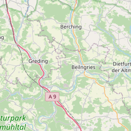
Bounding boxes: 11.5° .. 11.5° x 49° .. 49°
License: cc-by-nc-nd/4.0
Language: Englisch/English
Time ranges: 1998-02-01 - 2000-04-30
Accessed 1 times.