

Description: Understanding complex spatial and temporal biogeochemical interactions throughout a watershed and further characterizing the process-based integrated influence of these interactions on the surface water outlet loading remains elusive. This is particularly important in ungauged catchments with limited field data. The objective of this project is to examine the complex interactions through a series of field experiments, laboratory analyses, and numerical simulations. - Over 19 doctoral projects related to hydrology, biogeochemistry, meteorology, plant physiology, and socio-economic behavior are being integrated to evaluate the importance and sensitivity of each component within the watershed dynamics. - A variety of conceptual, topographic, and process-based models have been used to estimate the process-based hydrologic response to meteorological drivers. - HBV is a semi-distributed, conceptual model that was utilized in the upland forest portion of the project watershed to simulate observed surface water discharge. Soil moisture and storage response functions were the most sensitive and influential parameters in this forested headwater location. The results from this study are important to future investigations throughout the Haean since limited field data requires interpolating sparse data throughout the watershed and quantifying the processes that are most influential. The topography-based model TOPMODEL will be used in order to simulate hydrologic water fluxes through the same forest catchment. TOPMODEL is a physically based, distributed watershed model used to predict saturation excess and the - potential for saturation overland flow and subsurface stormflow. The finite element numerical code HydroGeoSphere will also be used to examine local groundwater and surface water interactions and implications on heat and solute transport. The semi-distributed SWAT model is being used in conjunction with the previously described models to predict the impact of land management practices on water, sediment, and nutrient yield. By analyzing temporal and spatial soil, land use, and management scenarios throughout the watershed long-term impacts on water quantity, water quality, and sediment transport can be quantified. The conceptual and topographic models are being used to predict the hydrologic response in the upper forested reach during periods without discharge records. These results can be coupled to historical biochemical data to estimate nutrient loading from this important source location. These and other simulations will be used to examine parameter sensitivities and impacts to better understand scaling behavior. Algorithms to examine the precipitation distribution throughout the unique punchbowl shaped basin are being developed that advance past simple interpolation or kriging. Extensive field-based meteorological data stations are being used to better quantify evapotranspiration and compare these values to other uniquely estimated values. usw.
SupportProgram
Origins: /Bund/UBA/UFORDAT
Tags: Biogeochemie ? Meteorologischer Parameter ? Evapotranspiration ? Meteorologie ? Nährstoff ? Ökologie ? Physiologie ? Oberflächenabfluss ? Sozioökonomie ? Bodennutzung ? Regenwasser ? Szenario ? Topographie ? Wetterdaten ? Oberflächenwasser ? Bewirtschaftung von Wassereinzugsgebieten ? Ackerfläche ? Management ? Bodenbewirtschaftung ? Daten ? Nährstoffkreislauf ? Oberflächengewässer ? Berechnungsverfahren ? Flächennutzung ? Simulation ? Ökosystemleistung ? Studie ? Wasserqualität ? Wasserspeicher ? Sediment ? Bodenfeuchte ? Grundwasser ? Wasser ? Einzugsgebiet ? Belastung ? Untergrund ? Gewässerqualität ? Flächenmanagement ? REACH ? Sedimentdynamik ? Nachhaltige Landnutzung ? Gebiet ? Sedimenttransport ? Wald ? Hydrologie ? Freilandversuch ? Verpackung ? Landschaft ? Niederschlag ? Wasserscheide ? Wassermenge ? Wechselwirkung ? Fluss [Bewegung] ?
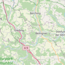
Region: Bavaria
Bounding boxes: 11.5° .. 11.5° x 49° .. 49°
License: cc-by-nc-nd/4.0
Language: Englisch/English
Time ranges: 2009-03-01 - 2012-02-29
Accessed 1 times.